Global Forest Watch - interactive website
The Global Forest Watch iniative hosted by CBFP's member WRI (World Resources Institute) offers a large choice of interactive maps for the Central African region on its website.
The World Resources Institute (WRI) Forest Atlases are map-based applications that facilitate visualization and management of forest information. With support from CARPE, WRI has partnered closely with Ministries of Forests in six countries across Central Africa to use a combination of GIS, remote-sensing and field-based technologies to vastly improve the quality of, and access to, information on protected areas, logging permits, mining permits, community forests and other land use allocations. The Forest Atlases have allowed for regular access to high-quality forest information - leading to reductions in illegal logging, reconciliation of over-lapping land claims, more effective land-use planning, better support for resource rights of local populations and overall improved forest governance. Find more under the following link: WRI Forest Atlases
2. CARPE map library - maps and posters of the Congo Basin
CARPE Mapper
Explore the 12 CARPE priority landscapes using CARPE Mapper, an interactive Web GIS for the Congo Basin.
CARPE Data Explorer
Conduct map based and keyword searches or browse the CARPE Data Explorer and download CARPE related GIS data, satellite derived products, maps and posters.
CARPE IMT
3. Congo Basin Satellite Imagery Resources
The following is a list of the major sources of satellite data available for the Congo Basin. Information is provided regarding satellite payloads, sensor characteristics, spectral resolution, spatial resolution, swath dimensions, and temporal coverage. Additionally we have supplementary links providing more details on these systems, plus several locations where the data can be accessed or ordered. Information on each data site is provided to further assist users in expediting their data queries and requests. When possible we have collected links that can help guide the user on the use of the particular imagery in areas such as band combinations or suitable applications for the imagery. A general introduction to remote sensing with satellite imagery for beginners can be found at the NASA Remote Sensing Tutorial.
Landsat - MODIS - ASTER - SPOT - CBERS - Very High Resolution - Radar - LiDAR
For more information, please consult the following Link:Congo Basin Satellite Imagery Resources
4. Spatial Data Resources for the Congo Basin
Located here is a collection of spatial datasets and links to important spatial datasets relevant to conservation activates within the Congo Basin. In addition CARPE host online services for several datasets. For CARPE generated posters of the region and the Congo Basin Forest Partnership (CBFP) landscapes visit the CARPE Map Library. For online visualization of Congo Basin datasets visit the CARPE Mapper. The same datasets that are visualized in CARPE Mapper can be viewed in ArcGIS, ArcGIS Online or Google Earth by accessing their specific services provided in the REST URL format.
Find more under the following link: Spatial Data Resources for the Congo Basin
5. Welcome to the Central African Regional Program for the Environment (CARPE) Information Management Tool (IMT).
CARPE supports a large-scale tropical forest landscape management planning process as part of its overall objective to slow the rate of tropical forest and biodiversity loss in Central Africa. This site is being made available to CARPE partners, stakeholders and members of the general public who may be interested in following the progress of this undertaking. Landscape planning is a highly dynamic process, and therefore the site will change periodically as new information becomes available. In principle, it will be updated only once each year, but changes and updates may be made at any time if warranted. The information is organized according to each of the 12 CARPE/Congo Basin Forest Partnership (CBFP) landscape programs according to the principal processes that CARPE partners use to develop both landscape management plans and macro-zone management plans. The guides and reporting manuals that describe this process in more detail are available on the main CARPE web site.
Please consult the CARPE Information Management Tool Home
Lessons from Cameroon: Forestry Impact Monitoring
Since 2001 the Government of Cameroon has embarked on a National Forest and Environment Sector Program (Programme Sectoriel Forêt et Environnement - PSFE) with the objective of guaranteeing the long-term sustainability of the economic, ecological and social functions of the forest ecosystems. The German Technical Cooperation (GTZ) supports the Government of Cameroon in the implementation of the PSFE through its own program called ProPSFE (Programme d'appui au PSFE). As part of its support, the GTZ has financed the creation of an impact monitoring system. This system, started in 2005, is based on a Online Indicator Database of 33 indicators (in the categories "natural resources", "good governance" and "poverty alleviation") as well as an interactive Online Atlas and an Online Library. Today it is one of the fully operational impact monitoring systems in Central Africa.
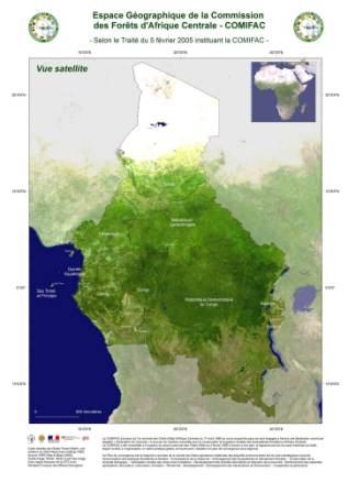
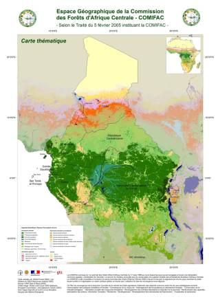
Geographical outspread of the COMIFAC region - maps


